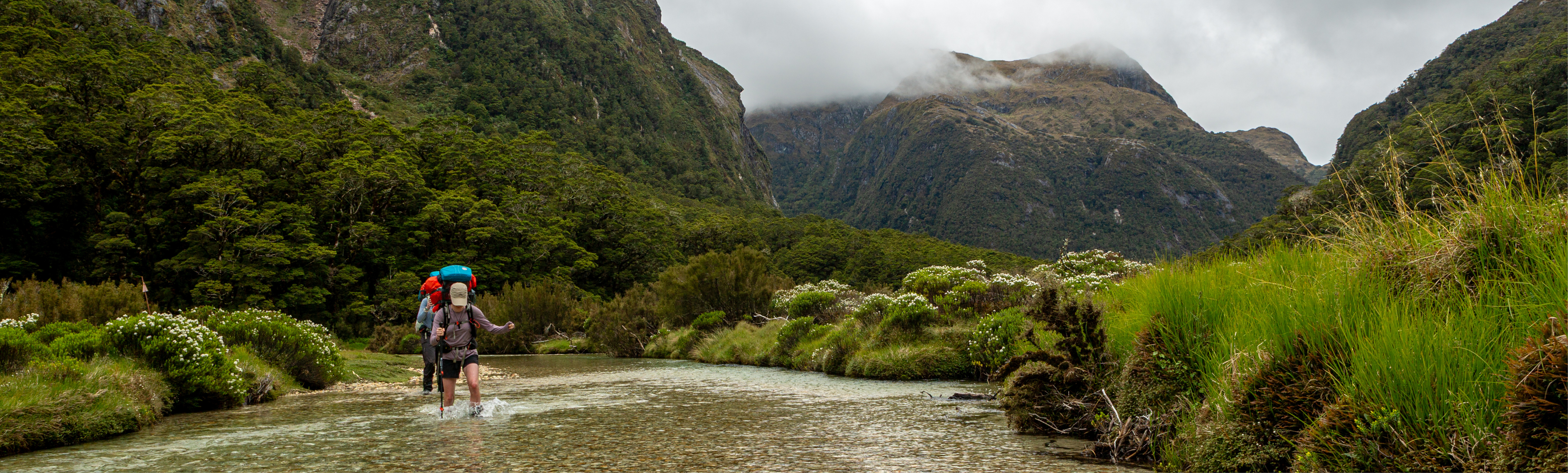
The beginning of twelve days off the beaten track in Fiordland National Park, New Zealand, as told by Sam Harrison of the Wellington Tramping & Mountaineering Club.
Days 1–3
Sitting on a bench outside the Milford Road Merchant, I blew on my pie. It was still too hot. I couldn’t help but ponder what was about to unfold. I was on the verge of the trip of a lifetime. Some months before, I had been given a scholarship by the Federated Mountain Clubs of New Zealand to undertake an expedition into the heart of Fiordland the coming summer.
My fellow expedition members were Tess, Ellen and Regan — master masochists of the finest variety.
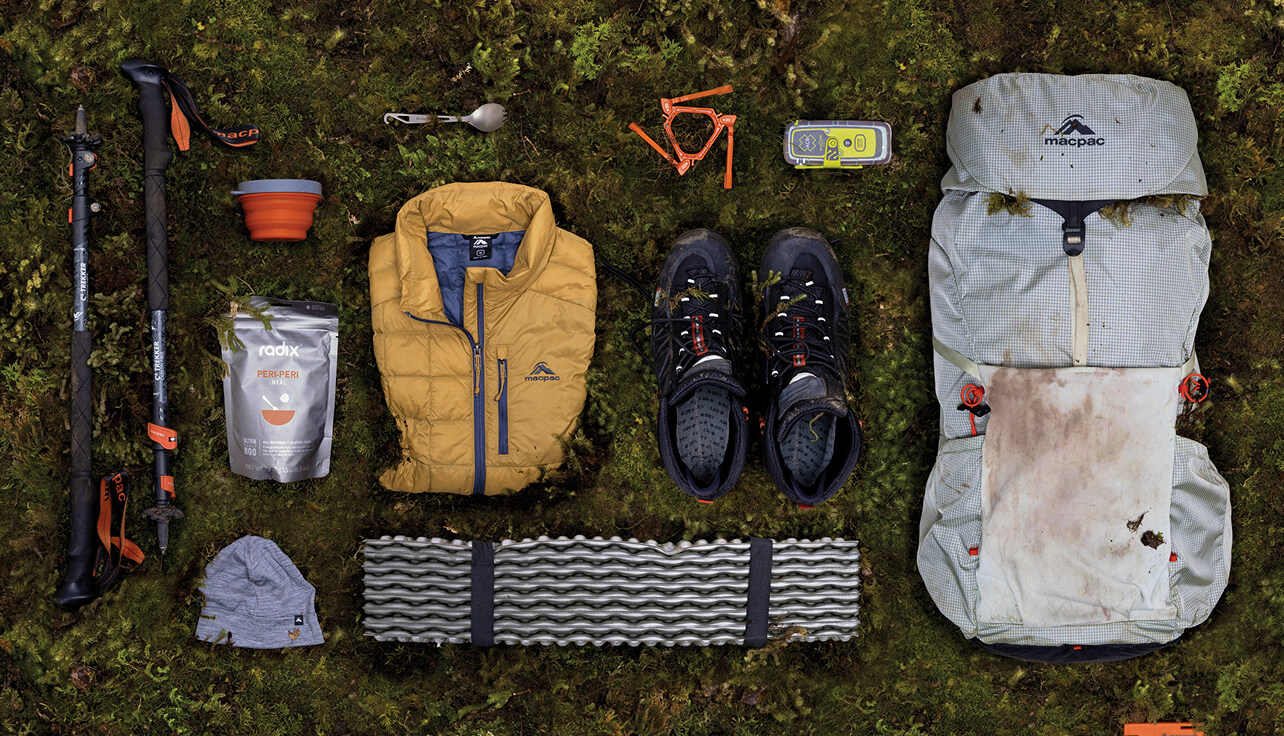
Our plan was simple: strike out across Lake Te Anau, climbing through the Murchison Mountains and into the Large Burn. We‘d follow this to Caswell Sound before turning up the Stillwater River and over Ethne Saddle to George Sound. From there, it would just be a matter of following the George Sound Route back to Lake Te Anau. Our packs would be crammed with twelve days’ of rations, dehydrated by Ellen and her mother who was visiting from the US. On top of the food, we’d each have a packraft. These had been lovingly handcrafted by Regan over the course of a month in his Newlands “sweatshop” (aka his garage). Pretty much everything else we were carrying had been supplied by Macpac.
Somehow, all of this preparation had come together, culminating in my pie. It was no longer thermo-nuclear, enabling me to take a bite, covering myself in pastry.
I. The Mysterious Case of the Disappearing Bivvy
The boat skipped across the broken water of Lake Te Anau. Mist enveloped the mountains around us. We were accompanied by a wiry German boy clad head to foot in wet-weather gear. His name was Marius. He had reached out to see if he could share the boat with us. We were somewhat apprehensive, as we had no idea how capable he was for the week he would be spending alone in wild country.
“Are you Sam Harrison?” Marius asked, “I’ve read your blog”.
All of my anxiety melted away in an instant. He must know what he’s doing. Marius disembarked at the outlet of the Doon river, waving us goodbye, growing smaller as the boat pulled away. Our stop was just across the bay, Junction Burn Hut.
We disembarked one by one, regrouping at the hut to admire the piles of sandfly corpses. Soon we left the relative security of the hut, crossing the boundary of the Murchison Mountains Specially Protected Area as we began up the Junction Burn track (the Murchison Mountains is a specially protected area and a permit from DOC is required to visit).
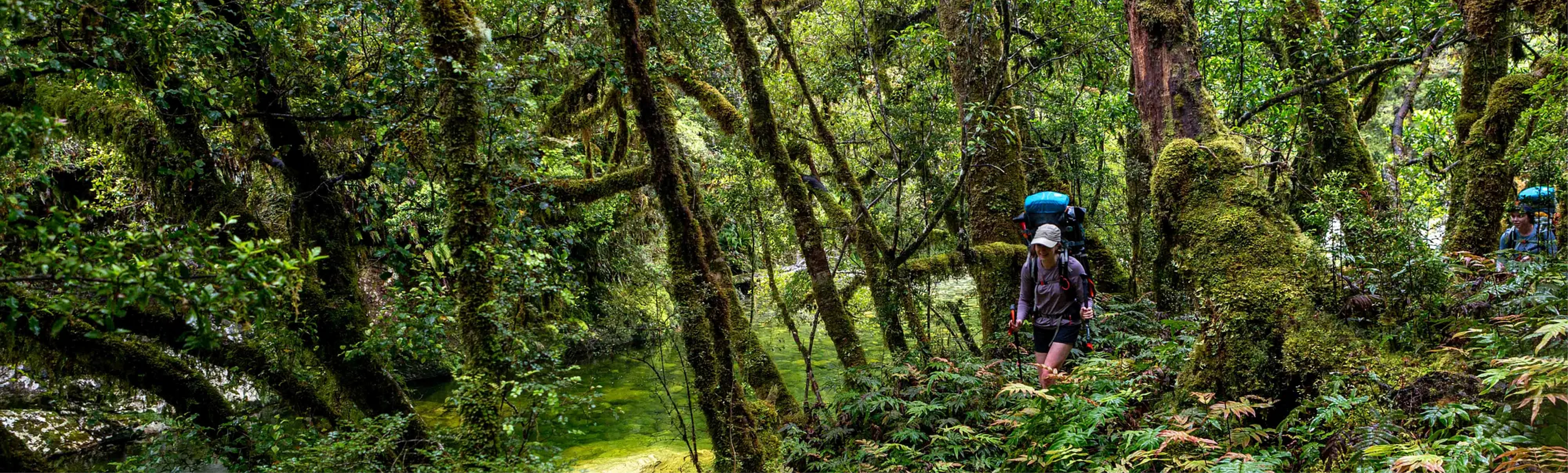
Our packs were heavy. The river forked and we began up the Woodrow Burn. Despite the dense rainforest around us the track was well cut. Better than some parts of the Tararuas even.
This, and the relative lack of elevation gain, meant we made good progress. This meant when we came acrosss the perfect lunch spot, a collection of large rocks jutting into the river, we didn’t hesitate to stop. Ellen was tasked with unpowdering the peanut butter, the result being more of a smoothie than a spread. Calories are calories. No sooner had we stopped the sandflies descended. This was great motivation not to hang around.
Water tumbled over these faces from streams unknown high above. Of course, all of this water meant the occasional bog, but this wasn’t unexpected.
The valley soon began to open up, the forest receding. The track brought us to a large swampy flat which gave us serious “hut vibes”. The map even agreed, Woodrow Bivvy was must be close. The problem was it simply wasn’t there. No matter how much we trod up and down the river could we find it.
It was only when we’d given up all hope that we stumbled on it. It was half a kilometre further upstream than the map showed, hidden by the bush edge.
It was a joy to finally take our packs off our backs. This elation was cut short by swarms of sandflies. We rushed into the cramped confines of the bivvy, climbing over each other to fit. The bivvy’s placement in a swamp meant everything had an underlying dankness. An entry into the hutbook summed it up far better than I ever could:
Woodrow Biv — sure ain’t roomy
Woodrow Biv — rather gloomy
At least the dimness
Masks the grimness
Of the mould
but truth be told -
This fetid little find
Could use some sunshine!!!
We did our best to remedy the situation, scrubbing mould off every surface we could get to. Tess and I then ventured across the swamp to find somewhere to swim. Post-swim we made haste back to the biv, our bare skin a magnet for the local sandfly population. We ate dinner inside before turning in for the night, eager to get some kip.
II. Robin Saddle: Dead or Alive
Our objective for day two was Robin Saddle Hut. As the kea flew it wasn’t a great distance. But kea don’t have to carry eleven days’ worth of food. Our morning start was not fast by any standard, progress hindered by the cramped conditions and lingering sandflies. We set at half-past eight, wandering across the end of the swampy flat before entering the forest. The track climbed steadily as the river gorged. The track might’ve been easily negotiable had it not been for our packs. The odd bit of fresh treefall was worst for Regan, his XL packraft paddle snagging on every branch.
The trail grew narrower and we traversed under bluffs before the markers plunged down a rock face. Gingerly, we negotiated this, mostly on our butts. From here our path meandered to reach the upper Woodrow flats.
On joining the flats Regan had a sudden realisation. He had been enjoying the last half hour too much. Something had to be wrong. Sure enough he was no longer in possession of part of his XL packraft paddle. Regan was not going to leave it behind. I backtracked with him for nearly half an hour till we found the part resting peacefully beside a stream. Phew. We returned to the girls, who were covered head-to-toe in an effort to combat the black clouds that hovered around them. They were eager to move.
Crossing a small flat we stayed on the true-right, climbing briefly before descending to a second flat. The route across the flat was well marked, meandering between huge flowering hebes and bottomless bogs. We entered the forest again as the valley turned to the west and after a couple of hundred metres we crossed over to the true-left of the Woodrow.
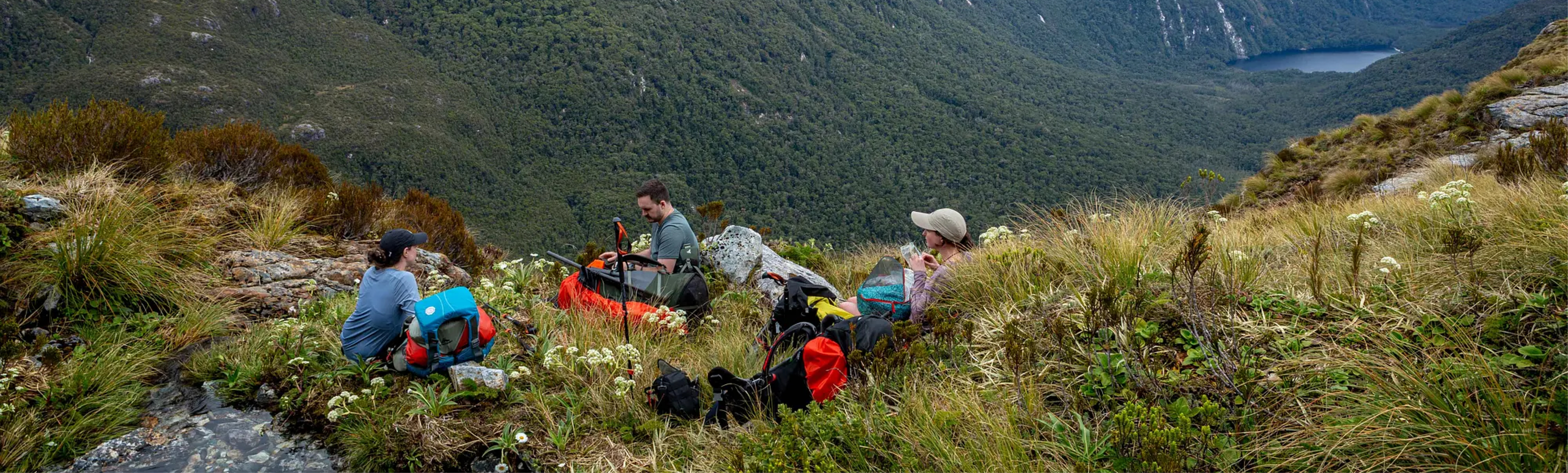
Here we encountered a few unexpected mudholes before we reached the grassy edge of a large silty flat. It appeared to be a favourite haunt of the Canadian geese. Halfway accross the flat we decided we were overdue for lunch. We dumped our packs and Ellen got busy rehydrating some hummus.
This led to the discovery that, while semi-rehydrated extra strength garlic hummus is partially edible, unfortunately it does little to repeal sandflies. No sooner had we inhaled the last morsels of food we were back on our feet.
Climbing further upstream the previously colourless water of the Woodrow transformed into a vibrant shade of blue. This distracted us from our garlic-troubled digestive systems. Further upriver we passed around a swampy lake, before doubling back to enter the bush for the climb to Esk Saddle. Grunts echoed through the bush as Regan and I struggled under our 90L packs. In a rare moment of kindness I offered to carry Regan’s tent. I regretted my genorosity. The track was little more than a marked face. It was a joy when we finally reached a rocky outcrop that offered our first views of the trip.
My elation was short lived. I was soon falling ass over tit as I tried to negotiate a rock. I dusted myself off, trying to preserve what little dignity I had left. We stopped for a break on Esk Saddle itself, enjoying a rare absence of sandflies. From here the route to Robin Saddle revealed itself, the saddle seeming impossibly distant. Leaving Esk Saddle and the track behind we came up against our first real obstacle. The ridge before us rose in a series of steps, sheer vegetated walls presenting a navigation puzzle. We put our faith in Regan. This proved to be wise, as he guided us along a narrow ledge and onto the easier slopes above.
We negotiated the next step in the ridge to pt 982 by weaving a steep diagonal course along its face. Lake Duncan and Lake Te Au lay far below us, shimmering like jewels.
It was a grunt up to the weathered rock landscape of pt 1096. Passing the highpoint, we continued to the base of the next hill. A steep scree strewn bench lay to our left, stretching out to Robin Saddle.
Tess led across the slope, scouting a way for the rest of us to follow.
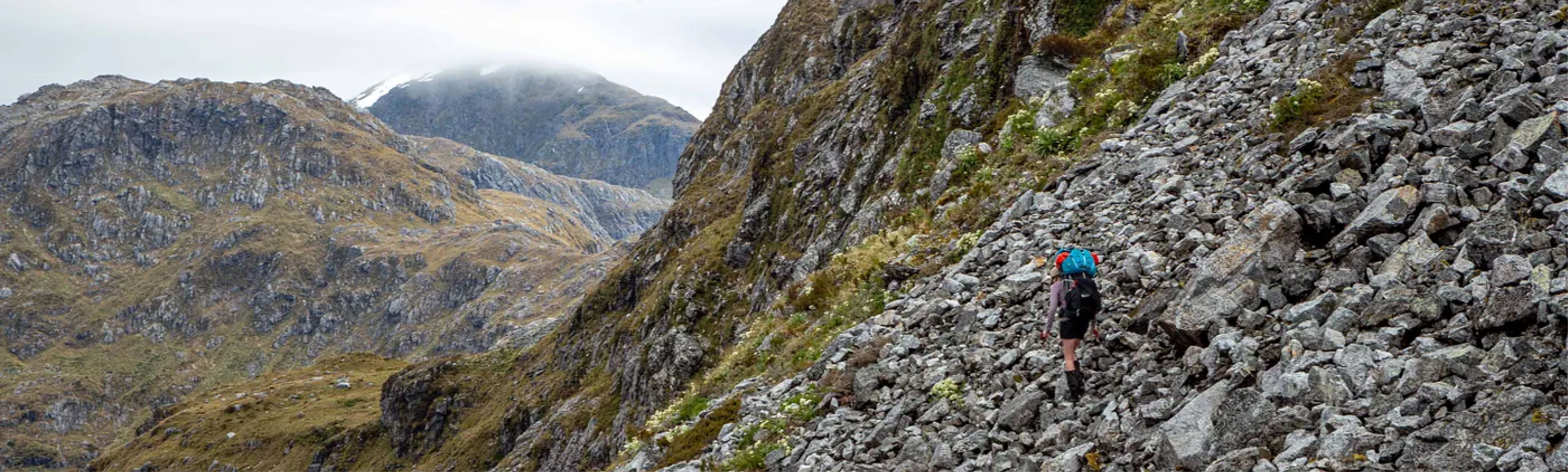
I don’t quite know how she was making it look so easy, I fumbled around on the loose rock, worried my pack was about to break my ankle. The first scree slope was followed by a second steeper one. Tess skipped down this, leaving the rest of us to figure it out for ourselves. Following some slipping and sliding I was reunited with her on slightly flatter terrain. From here we climbed over a large bouldery spur, weaving our way through stunted vegetation. On the far side there was a stream. It tumbled down from the cliffs above into a pool, suspended above the valley. Our weary bodies demanded a snack. Two “juvi” kea joined us.
From the pool we climbed up tussocked slopes, gaining the rim of a large basin. We continued due west and after consulting our notes began climbing a spur towards pt 1161. This was a steep plod. After gaining some altitude we sidled a rocky ledge, then climbing up gradual slopes till we were standing on the plateau above Robin Saddle.
Peering over the other side we found that we were far from close to our objective. Robin Saddle Hut lay far down below.
The optimal path of descent was not obvious. Moir’s Guide mentioned a cairn marking the route from here, but we lacked the energy to properly search for it. Instead, we gingerly made our way down a rocky gut. It was a relief when this opened out into the more gentle slopes of a scree fan. The bottom of the fan connected with a large shelf.
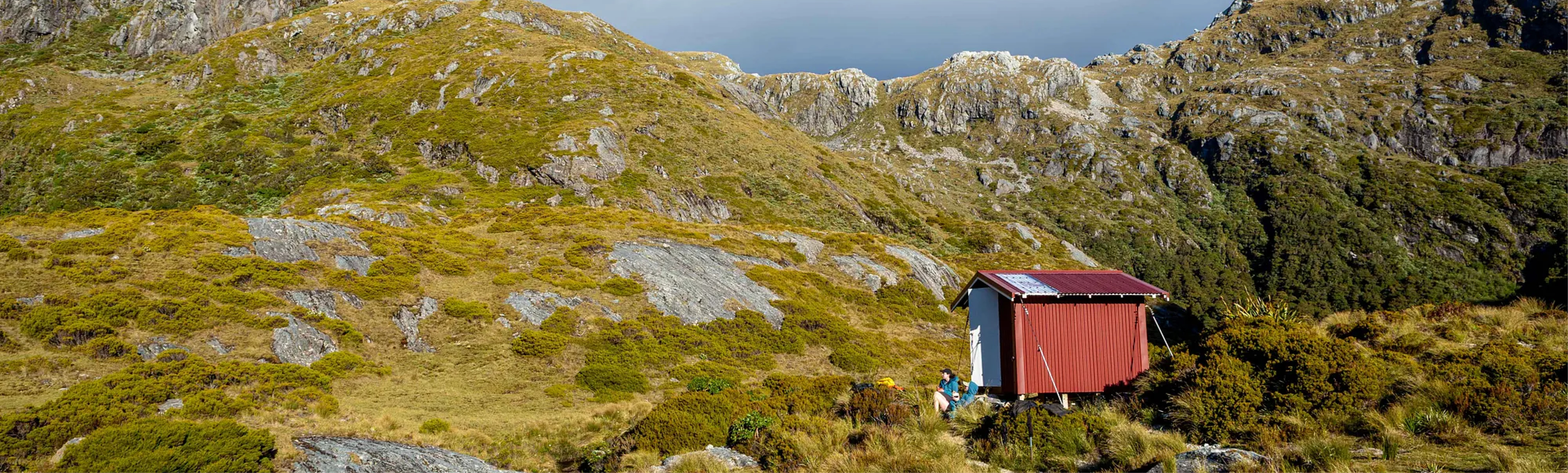
Following this west we crossed over a small stream and began our final descent to the hut. I took the risk of having to wade through scrub to maintain the shortest path to the hut. Our broken bodies collapsed outside the hut a little before 7pm.
Our legs seized and we were paralysed by our fatigue. The thought of ever leaving Robin Saddle filled me with nausea. Basic mental functions failed to fire. It was abundantly clear to all that pasta was required before we made any adult decisions about our plans for the next day. Indeed, mountains of pasta did improve our mental capacity. We resolved to have a rest day at the hut. Our knees rejoiced.
III. Maiden Voyages and Mountain Daisies
It was sleep ins all round. When I eventually poked my head out of the hut I was greeted with an uninviting swirling mass of grey cloud. Later in the morning the girls got up and we went down to the lake to check out its packrafting potential.
Regan woke from his slumber around half-past eleven, declaring “I have to have a nap to recover from my sleep”. He was soon snoring again. When our paitence ran out we dragged him into the world of the living, whether he wanted to be there or not. We ate lunch before we all mucked in for a bit of hut cleaning as part of our commitment to FMC.
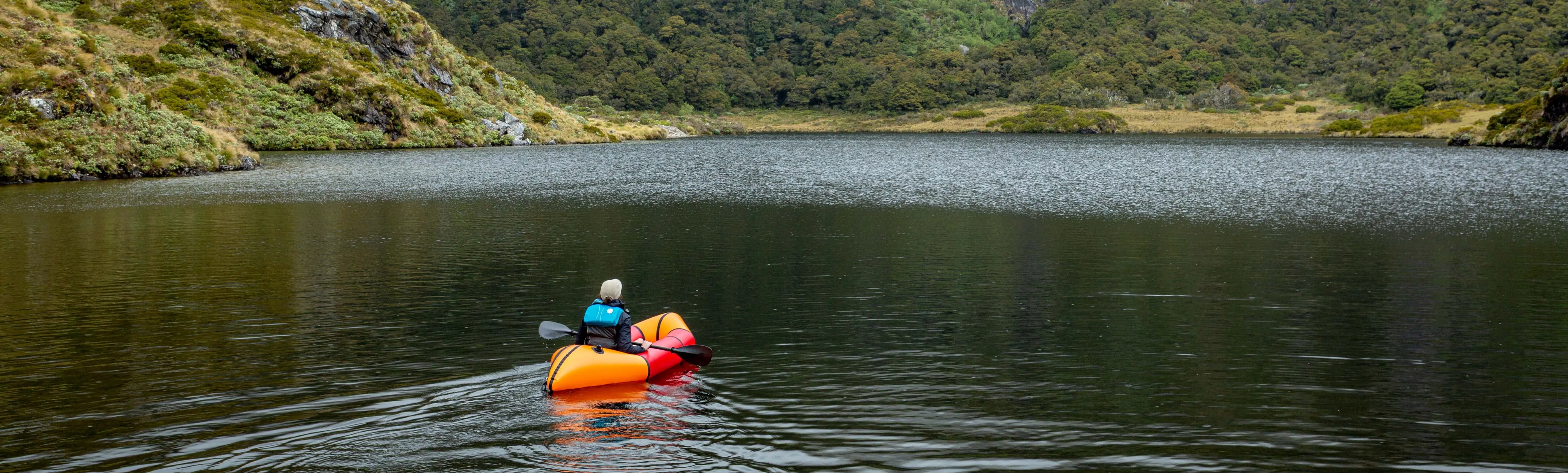
Once the mattresses were scrubbed and laid out to dry it was finally packraft time. Regan began with an introductory safety talk, citing the best Youtube videos out there and zero personal experience. Following this we set about inflating our rafts by the lake.
One by one the packrafts were launched, occupant and craft cheerfully wobbling their way out into the lake.
After a circumnavigation and plenty of photos we headed back, satisfied with our efforts. In the afternoon we kept ourselves busy completing the crosswords from the hut’s stash of Wilderness Magazines.
“What’s an eight letter word for mountain daisy?”
When this resource was exhausted the others dug out their kindles. Not owning one, I decided to go for a walk. I headed northwest from the hut, crossing the stream and climbing up a knoll so I could see down towards the Irene River. It was a spectacular place of sheer-sided mountains and lush vegetation. The shriek of kea echoed around me.
My curiosity led me further down the hill. In the mud I chanced upon a large footprint, later confirmed by Ellen to be that of a Takahe. I was chuffed. Two kea landed on a rock near me as I retraced my steps. I chatted to them for some time.
As I crossed back over the knoll the girls came out to greet me. They too were getting restless legs. I told Ellen about the kea and she was off in a flash, not one to miss ornithological action.
We spent the remainder of the time before dinner reading the hutbook and wondering what tomorrow would bring. We planned to tackle the side of Mt Irene if the weather was good, traversing its western flank. Otherwise we would do a long slog down to the Irene River and then back up. Regan reaasured us that his InReach forecast showed little rain for the next week. Before the trip I had talked to a friend of Tess’ dad, John Cocks, who had done the traverse before and said it was doable. His parting words were somewhat ominous:
“Whatever happens, you’ll have your own adventure”
I didn’t dwell on this, the shepherds pie steaming in the billy was demanding my full attention. No point worrying about the future.
Follow this link to find out about traversing the crux of Mt Irene in part two.